*For serious hikers, there are a number of trails that offer peak experiences. Two of the most venerable—each located at opposite ends of the continent—are the Appalachian Trail (stretching from Mount Katahdin in Maine to Springer Mountain in Georgia) and. the Pacific Crest Trail (stretching from the U.S./ Canada border in the Pasayten Wilderness and the E. C. Manning Provincial Park, to the town of Campo, California. on the Mexican border) To this number can now be added the Great Plains Trail, a 2,100 route that crosses the prairie from the Canadian to the Mexican borders.
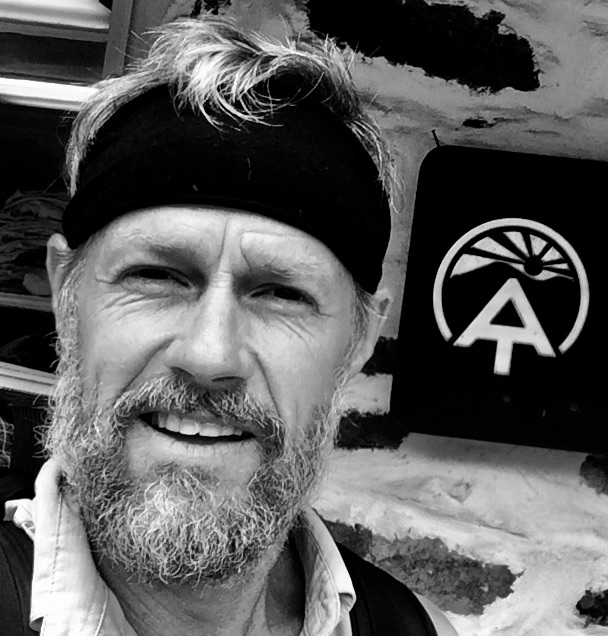
Clay Bonnyman Evans (AKA “Pony”), one of the board members for the Great Plains Trail Alliance, has been associated with the development of the trail from the beginning. Pony has hiked nearly the entire trail, and Rootstalk Associate Editor Cara Keleher spoke recently to him recently about his experience. 1
Rootstalk: Can you begin by talking about your connection to the Great Plains Trail?
](https://rootstalk.blob.core.windows.net/rootstalk-2020-fall/grinnell_29623_OBJ.jpg)
Great Plains Trail Map courtesy of the Rapid City Journal
Evans: Sure. I spent almost all my life in the Mountain West and California. I was born and raised in Colorado, then worked as a cowboy in Wyoming, then lived in New Mexico and California, then became a journalist after those cowboy years—which is what I was originally was going to do before I did the cowboy thing. I worked for newspapers for a number of years. I’ve always been an outdoors person, but when I was about 54 (I’m 58 now), I took my first long distance hike on the Colorado Trail, which is about 500 miles, and I really, really liked it. I mean, I really liked it. So, the next year I hiked the Appalachian Trail, and then started doing some lesser-known trails—the Foothills Trail, (in North and South Carolina) the Pinhoti Trail, (in Alabama and Georgia) just different places. And—it must have been 2018, but I can’t even remember exactly how it all went—I found a story on the back page of Backpacker Magazine, and it was an interview with Steve Myers, who just happened to live about six miles from me in Colorado. The article was about Steve’s long interest in starting something called the Great Plains Trail. At that point, he’d been doing things with the trail for—oh, I don’t know, 7 or 8 or 9 years even, and it was really his brainchild. He had grown up in Minnesota and driven across the Northern Plains frequently, and he’d always been fascinated by them. He just got intrigued by the idea of a long trail across the Great Plains. We have these long trails that go up California, Oregon, and Washington; and the Continental Divide Trail goes through New Mexico, Colorado, Wyoming, Idaho, and Montana; and the Appalachian Trail—the famous one—goes through fourteen states. So, Steve just thought, the plains deserve some respect, maybe we can do this here. So really, Steve’s the guy that got the whole thing going. The Backpacker story got him some attention, and it certainly caught my attention, because growing up in Colorado, I was of course involved in mountain stuff, very outdoors, and when I was younger, my family used to go out to a big reservoir in western Nebraska. Starting then, but accelerating when I got a little bit older, I just thought, people are always so into the mountains, and that makes sense, but they don’t realize the amazing things that are here. If you look east where I was in Colorado, the Great Plains were just incredible! So, because of that, I was fascinated with the story that I read about Steve, and I contacted him and got involved as a volunteer doing various things involving the trail. And then last summer—one of the things the board was doing last year was kind of trying to come up with a “pilot trail,” because when you create something like this, that is 2100 miles, you’re not going to have a foot trail all along the way. A lot of it’s going to be on roads, or dirt roads, and you have to figure out where the public land that you can route it across are. Steve’s done that work for years, and they wanted to come up with an option that they were calling the pilot trail to sort of test a 350- mile section that people could do either on bike or on foot. There is one person who is also on the board (and I am now on the board) of the Great Plains Trail Alliance, Luke Jordan, who is the only person to date known to have actually hiked the whole trail. The trail changes all the time, so what Luke actually hiked, back in 2015 or 2016, is a little bit different than what I did last summer, which is hike the pilot trail from Bear Butte, South Dakota, outside Sturgis, down to Scotts Bluff, Nebraska.
Rootstalk: How has the route been chosen?
Evans: It’s mostly been Steve’s effort. He was just interested in this and wanted to make it happen. He was living in Colorado at the time, and he just started going to the areas he thought might work and looking at maps, and he ended up coming up with a route going across public land. And if you’re doing a long hike, you need to be able to go into town to buy food, and plan your route around water sources, so Steve did that. It’s gotten more refined over time, particularly up north. Nebraska, South Dakota, and North Dakota are mostly on public land now—not entirely, there’s still plenty of dirt road walking—but a lot of that section is now on public land. So that’s what it was—identifying public land, identifying water sources and towns and things like that. And at this point, the further south you go, the less developed it is. When Luke hiked the whole thing, he needed vehicle support. He needed somebody with a car that could help him. What ended up happening was board members from the organization gave a week each and went down to support him. And that makes sense, because there’s just so much road walking, and there’s no public land for him to stay on, and so forth. So, he walked the route, but they would pick him up to take him into town or take him to a campsite, things like that.
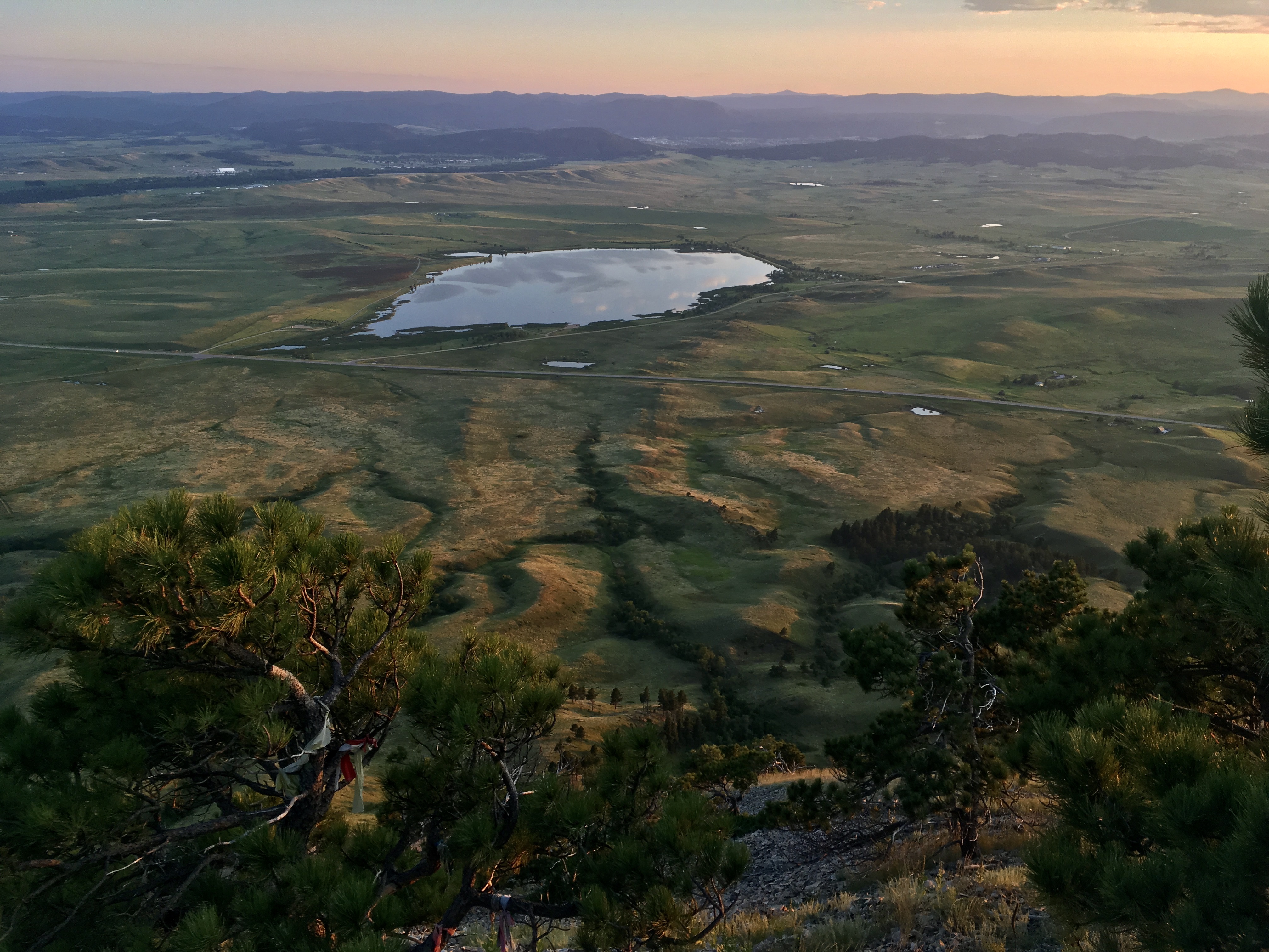
Looking west toward Sturgis from the summit of Bear Butte, SD (northern terminus of GPT pilot trail and Centennial Trail) at sunset.
 South Dakota](https://rootstalk.blob.core.windows.net/rootstalk-2020-fall/grinnell_29566_OBJ.jpg)
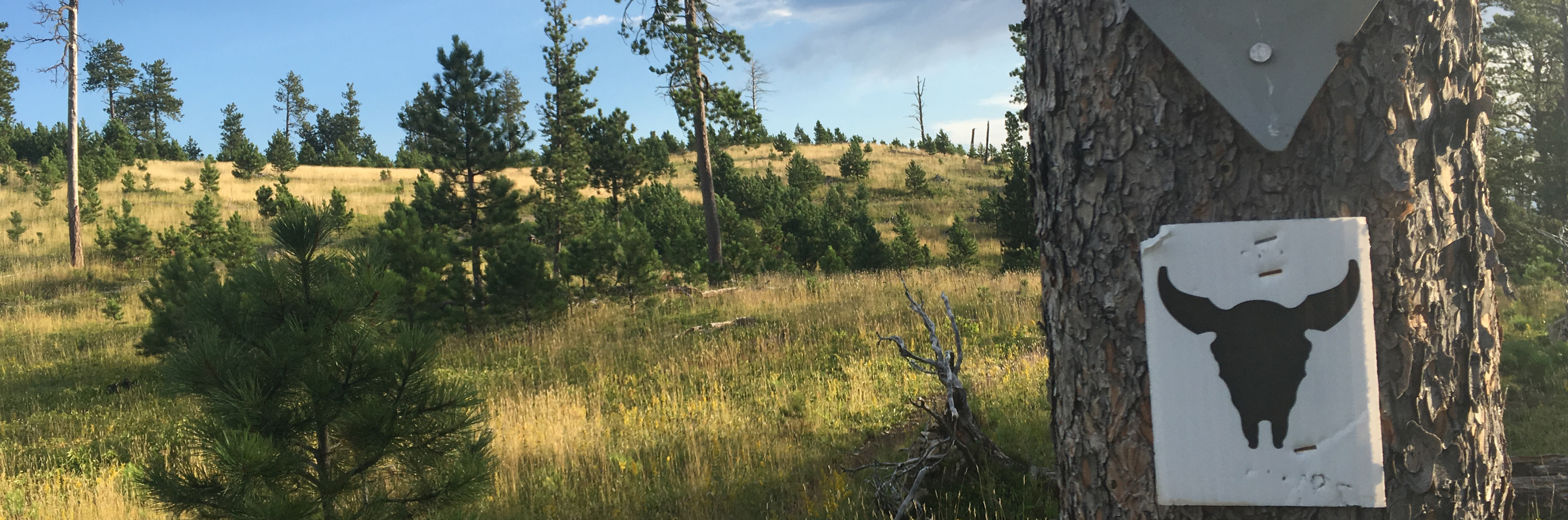
A bull bison who was blocking the trail early one morning in Custer State Park, South Dakota
Rootstalk: Can you talk about your personal experience on the trail last summer?
Evans: Oh man, I loved it. Like I said, I have an interest in long distance hiking, and I wanted to help the organization because, we were trying to put this idea out there, and besides Luke, nobody had done this, so I said, you know what? I’d love to just go walk and see what it’s like. My timing was important, because at the time, Omaha Public Radio had a reporter who was interested in doing part of the trail, so we timed it for her schedule. This worked out okay, but it just happened to be the incredibly hot, hot, hot late August/ early September of 2019. I started at Bear Butte, which is outside Sturgis, South Dakota, and the first roughly 125 miles from that point are actually contiguous with the Centennial Trail, which goes through the Black Hills.. It was great! I mean, it’s a real trail. I didn’t find any other backpackers on the trail; I only saw occasional people at trailheads. There are sufficient places where you can walk a mile or two off the trail to get supplies, the water was great for me that year (it can be difficult at times if it’s a drought year) It’s just fantastic. It’s beautiful. It’s pine foothills. It was excellent, I loved it. After that section you wind up in Wind Cave National Park and then you go down to Hot Springs, South Dakota, which is a great little trail town – it doesn’t know it yet, but it’s got natural hot springs and plenty of cheap motels where you can do your laundry, and all that stuff that thru-hikers have to do. So, I went there, and then I started west. A little bit of road walking out of town, and then I was back on dirt roads and camped west of town. And then I continued west and hit a rails-to-trail bike trail called the (George S.) Mickleson Trail—beautiful also, well-groomed for bikes, and they even have a water cache system there. Then down to Edgemont, South Dakota, an old rundown rail town, and from there, I had a pretty hefty day of doing mostly dirt road walking down into Nebraska, into the Ogallala National Grasslands. And then I crossed the grasslands, which are just unbelievable. I mean, they’re just so wide open, and there really aren’t fences. A lot of it is private property, a lot of it is managed by the Bureau of Land Management, but just gorgeous. But no shade, and very little water, so I had Steve and Luke (who just happened to be out in the area scouting route changes in South Dakota) stash water for me, which was really good. It turned out I would have been okay, because I could have gotten water along the way, but it was nice to have. And then down into the little town of Crawford, Nebraska, which is again, a great little trail town, I mean, just perfect. And then, southeast of there, back onto a trail called the Pine Ridge Trail, and then more dirt road walking down towards Alliance, Nebraska. And then west on farm roads, dirt roads, and those are very long days that I didn’t even do all of. If you’re going to do that, you would have some very long days there, unless you had vehicle support. But really, it was spectacular. It’s just a part of the world that so few people know about and see. It’s beautiful, it’s wide open, you’re not going to see anybody else walking, nobody. For me it was a very solitary experience, except for the three days that I was with the radio reporter and her camera guy. It’s just spectacular, it’s gorgeous. There are hills and antelope up in the Black Hills, and cutting through state parks you see buffalo, hawks, snakes, and canyons. All this stuff, and people call the great plains “fly-over country” but it’s not. It’s just spectacularly beautiful. I loved it. I loved it a lot.
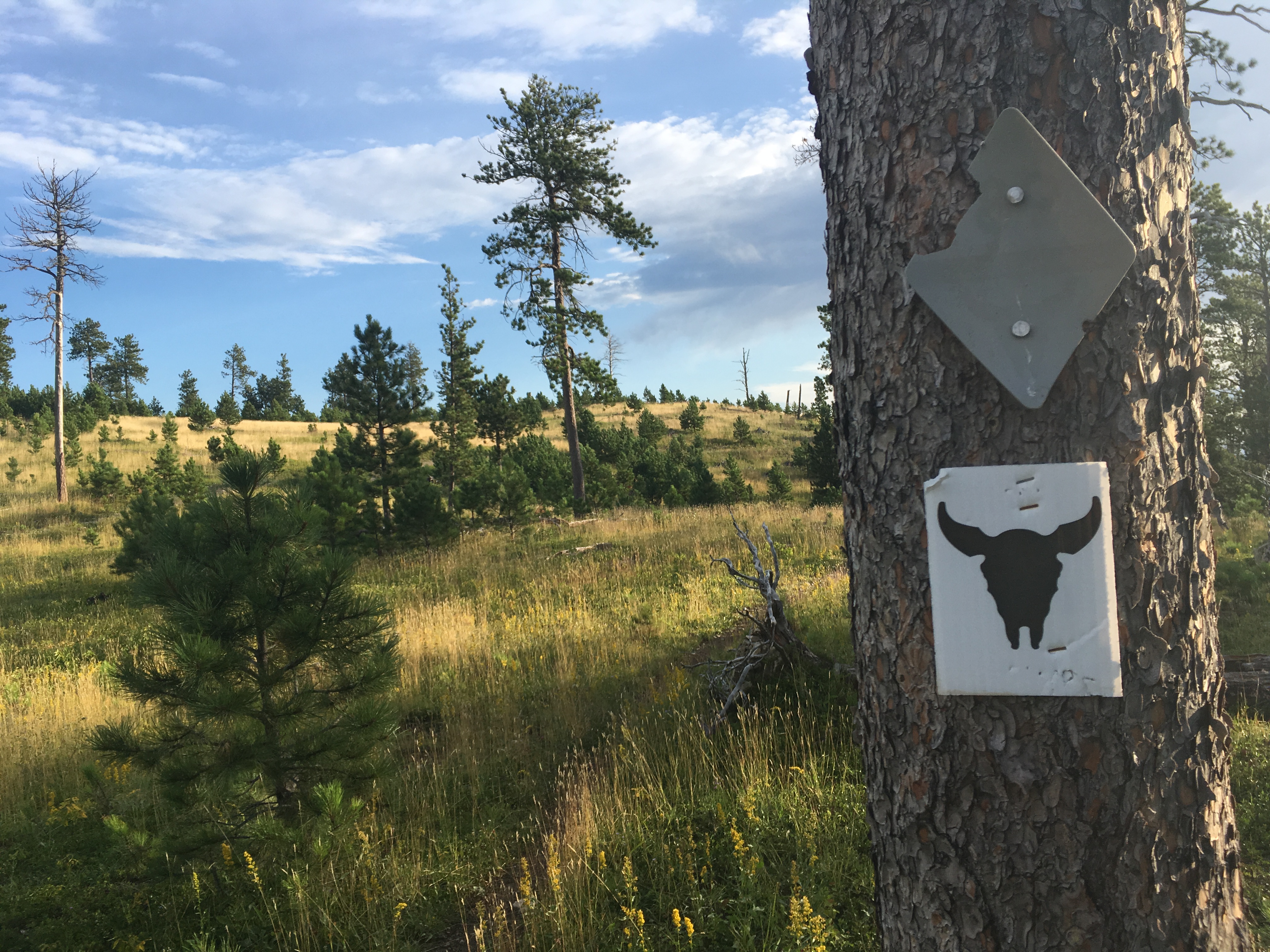
A ‘confidence marker’ on the Centennial Trail in South Dakota. The Great Plains Trail is contiguous with the Centennial Trail through the Black Hills
Rootstalk: How many miles did you end up hiking?
Evans: It was about 300. I did skip some of the road walking. Part of that was a matter of convenience. First of all, I’ve done plenty of road walking. I wasn’t out there trying to take every step of that route necessarily. We wanted to see how feasible it was, and those road walking days would have been almost 40 miles. That is a long day, even if you’re very, very in shape. And then it just happened that the radio people were able to get me a ride that would allow me to just skip that section. It wasn’t that important to me to do it, so they dropped me off so that I didn’t have to do the long road section there.
Rootstalk: You’ve mentioned that you’ve done a lot of hiking on various other long trails throughout the US. How did this experience compare, or how was it different from those experiences?
Evans: Well, let’s take the Colorado Trail and the Appalachian Trail. Those are two of the better-known ones that I’ve done. Something that I didn’t really anticipate when I did the Colorado Trail—and by the way, I consider myself to be a fairly solitary walker, and I also climb a lot of mountains and mostly do it by myself—so what I wasn’t anticipating was the community. And the Appalachian Trail especially—every single person that does it winds up being so pleased that community was such a big part of it. Because, you’re meeting people, you’re forming what people call trail families, you may be walking with the same group of people for a few hundred miles and then breaking apart, whatever. So, community is a big part of a lot of thru-hiking experience. There is no such thing on the Great Plains Trail. It’s new, it’s not well-known yet—I wrote a little bit about it and about the Centennial Trail after I finished, and I certainly heard from a couple dozen people who were interested in doing either the Centennial Trail or all or part of the pilot trail. And that’s just really what it takes. I mean, that’s why I did it partly. It takes people doing it, and learning what it is, and wanting the challenge, and so forth. So that’s the biggest difference. I saw almost no one else, except for people in town, until I met the radio reporter. So that’s a piece of it. It’s also very different in that most trails, perhaps understandably, are mountain-focused. And there are definitely hills and ridges, it’s not flat, and the Black Hills are real mountains, they’re just low mountains. But it really is very wide open, and a lot less mountainous, and you’re just traveling through very sparsely populated country, for the most part. So, even if you’re going to town—sure, Hot Springs is a real town, and Crawford is a real town, but they’re small, they’re really small. So those kinds of things. And, you know, I was camping by myself every single night, except for the couple nights that I was with the radio reporter, and you wouldn’t generally expect that on most of the other, better-known trails. And if you’re a person that worries about that, or isn’t into that, that’s fine. This trail is not going to be for you. Or, go with another person. But if you are a person who likes that kind of solitude, and adventuring by yourself, it’s a spectacular experience, it really is.
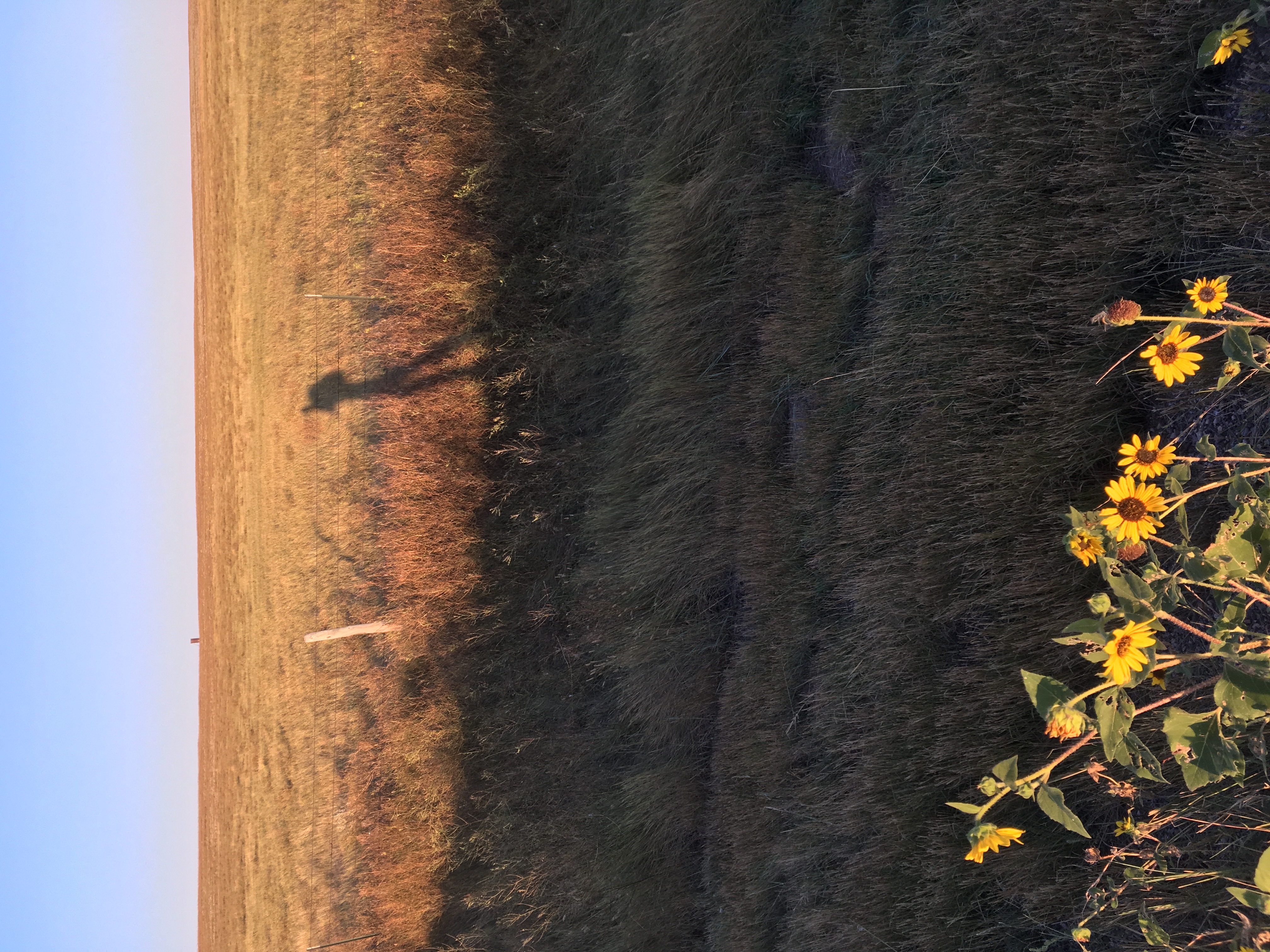
Pony casts a long early-morning shadow as he walks south of Edgemont, South Dakota
Rootstalk: Do you see the trail becoming more widely used in the future, or do you think it will remain a more solitary hiking trail?
Evans: The Pacific Crest Trail goes back to the 1930s, the Appalachian Trail goes back to the 1920s, the Continental Divide Trail goes back to the 1950s or 1960s—you know, these have been around a long time. And part of the reason that I got involved with the Great Plains Trail is that I thought to myself, well, you’re not probably going to see how something like this happens from the ground-up, or frankly, doesn’t happen, aside from this. And for years and years, it really was just Steve doing it—it was almost like a hobby. But over time, we’ve gotten a fair amount of media, and the route has gotten more refined, we have a board that’s more organized—so all the little steps you would imagine that have to happen to make it more permanent—I think they’re happening. I’m not going to predict that it’s going to become the Appalachian Trail of the Great Plains, because it’s an advanced trail for the most part. Not all of it—the Centennial Trail part is a great beginner trail, like true beginner. But for the rest of the trail, you have to be willing to do some long miles, you have to carry food and water for longer distances and so forth, so I don’t know if it’s going to stick, but what I can say is that all of the arrows are pointing in the right direction, and we certainly have gotten the attention, and we certainly have gotten more people interested. At least a half dozen people have contacted me, and ended up hiking at least the Centennial Trail. It’s a slow, deliberate process, but I’d love to see it happen. I think Steve is correct when he says that we need to remember that this can be a bike trail too. There’s a whole separate bike route—it’s very similar to the hiking route, but there are several places on the hiking route that you can’t take bikes, so there’s a whole separate bike map. So, I think the trail just has to find its place and its audience. Again, I wouldn’t dare to make a prediction, but I see all the arrows pointing in the right direction.
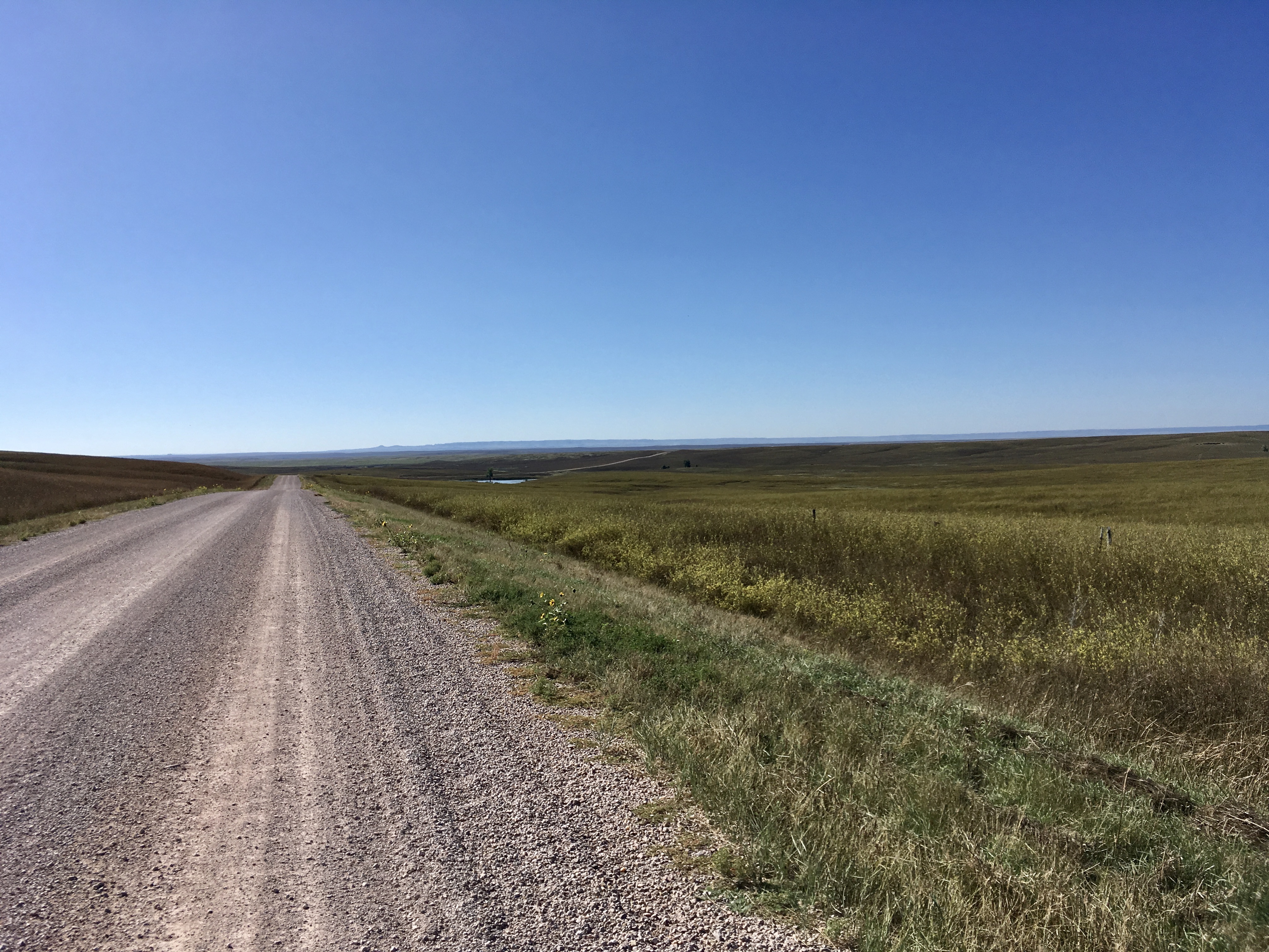
Long, straight road from Edgemont, SD into Nebraska
Rootstalk: You mentioned biking—do you know of anyone who has biked the route?
Evans: At this point the whole thing is more bikeable than it is hikeable. To our knowledge, no one has biked the whole thing, but I have a friend who has biked almost all of the Colorado section, so it is very doable by bike. The difference is really that you can go a lot more miles per day on a bike. Even a very sturdy hiker—only a tiny percentage of people—are going to be able to do 30 miles a day on a regular basis. So, let’s say a very strong hiker is doing 20, 25 miles a day. Those are long days, especially if it’s hot. But on a bike, a similar effort can get you 100 miles.
So, the problem with the distance between public lands where you can camp, or waterholes, or towns, becomes an easier logistical issue when you can go 75 or 100 miles a day. I’d love to see somebody try to bike the whole thing—it’s super doable.
Rootstalk: Where do you see this project going in the future?
Evans: It’s always being refined. Part of the section that I hiked outside of Crawford, Nebraska went over some dirt roads to get to the Pine Ridge Trail, and there’s a wildlife refuge to the west of there. We’re working with the rangers there and Steve has gotten permission to route the trail through there. This is kind of how it happens. What that means is, when that happens, suddenly those miles—8 miles, 10 miles, whatever it is—are going to be through wild country and trails. So those kinds of things are happening. Last year when I was up there, Steve and Luke were scouting north of where I started—north of Bear Butte, north of Sturgis—and they had come up with a route that takes advantage more of public lands, and they had gotten to know the owners of a tiny general store in the town there and asked them if they would be willing to be on the route—you know, could people could throw up a tent there for 10 bucks, or whatever? So, those things are just happening all the time. And I haven’t been up there, but apparently North Dakota is mostly on public lands now, so that’s pretty impressive. I expect it will continue going like that. Again, it’s much more challenging in the South, because if the public lands are there, they’re there. If they’re not, then what do you do? What we’ve talked about is maybe down the road we can get public land easements. That happens on other trails. So, the trail is always being developed. We don’t have a ton of money, so we’re not buying land like the Appalachian Trail Conservancy, which was able to partner with various local communities to complete that trail, which is entirely on public land or public easement land now. But it’s slow and steady, and I expect that to continue. We do need to focus more on raising resources so that we can do what that the ATC is doing. Well down the road, if we had that kind of money, it would be great to partner with the Nature Conservancy or something to pull out some land and get an easement where we could use it as trail, and it’s preserved and so forth.
Rootstalk: Where does the money for the trail currently come from?
Evans: Right now it’s just donations. I’ve worked for nonprofits in the past, and I’d like for us to get more engaged with trying to get some grants and things like that. I think there have been small pieces of money from grants in the past, but again, it’s coming together, and it’s a slow process. And for me, that’s really interesting to watch, because we do have people with different areas of expertise now. We have an academic from the University of Illinois, I’m a media person, which helps with publicity … so it’s been pretty cool to watch it all happen, and I expect it will continue.
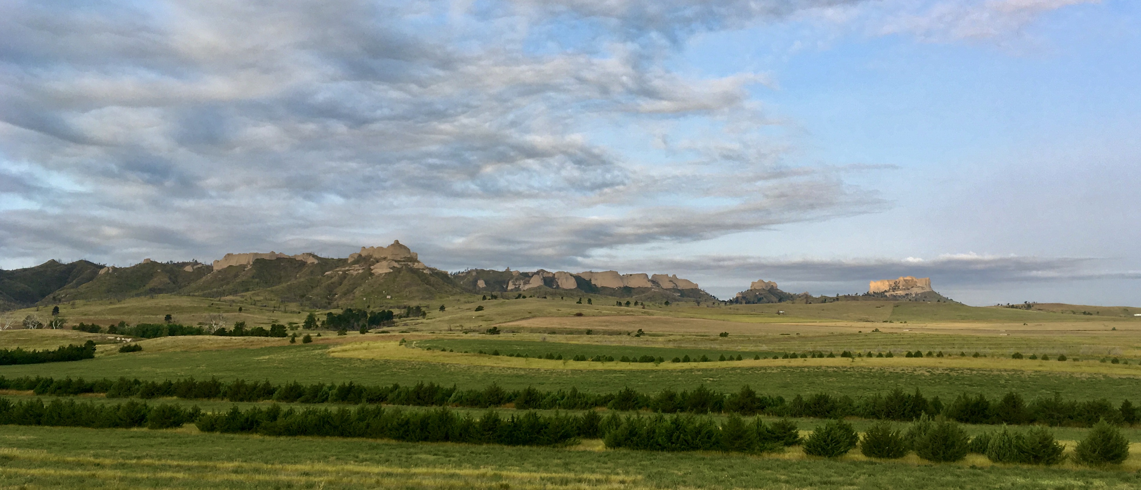
Bluffs outside Crawford, Nebraska. The trail was recently rerouted much closer to the bluffs.
Rootstalk: Is there anything else we should know about the Great Plains Trail?
Evans: Well, if anyone is interested, they can go to greatplainstrail.org.. There’s an interactive map there, as well as a media section, which is a really great way to get a sense of what the Great Plains Trail really is. The website has interviews with people like me and Steve and Luke, who have some real familiarity with the trail. There’s lots of good resources there. And there also is also a contact form on the website, to reach us. And, by all means, if somebody thinks they’re interested in doing part of the trail, they’re welcome to contact me directly ([email protected]) I love talking with people about the trail. I’m certainly very familiar with the Nebraska and South Dakota parts of the trail, and Luke is familiar with the other parts.
Rootstalk: What are your own future hiking plans right now?
Evans: Well, I was supposed to hike the Pacific Crest Trail this spring, and you know what happened [the COVID-19 pandemic]. But I am hoping to do at least part of the PCT this coming spring. I would like to do what’s calling the Triple Crown, which is thru-hiking the three best-known long trails – the AT, the PCT, and the Continental Divide Trail, which goes from New Mexico up to Montana to the Canada border. I’d love to do that. I’m still in good shape, despite my age, so I do hope that I will get the chance to do it. I do hope that this spring I’ll be out on the PCT. In the meantime, I’m always doing little things. I’m leaving next week to do a workshop for people that want to hike the Appalachian Trail. I write for a website called the Trek and I just published a book about my Appalachian Trail journey, The Trail is the Teacher: Living and Learning on the Appalachian, so I love the world of thru-hiking, and I try to stay plugged into it any way I can.
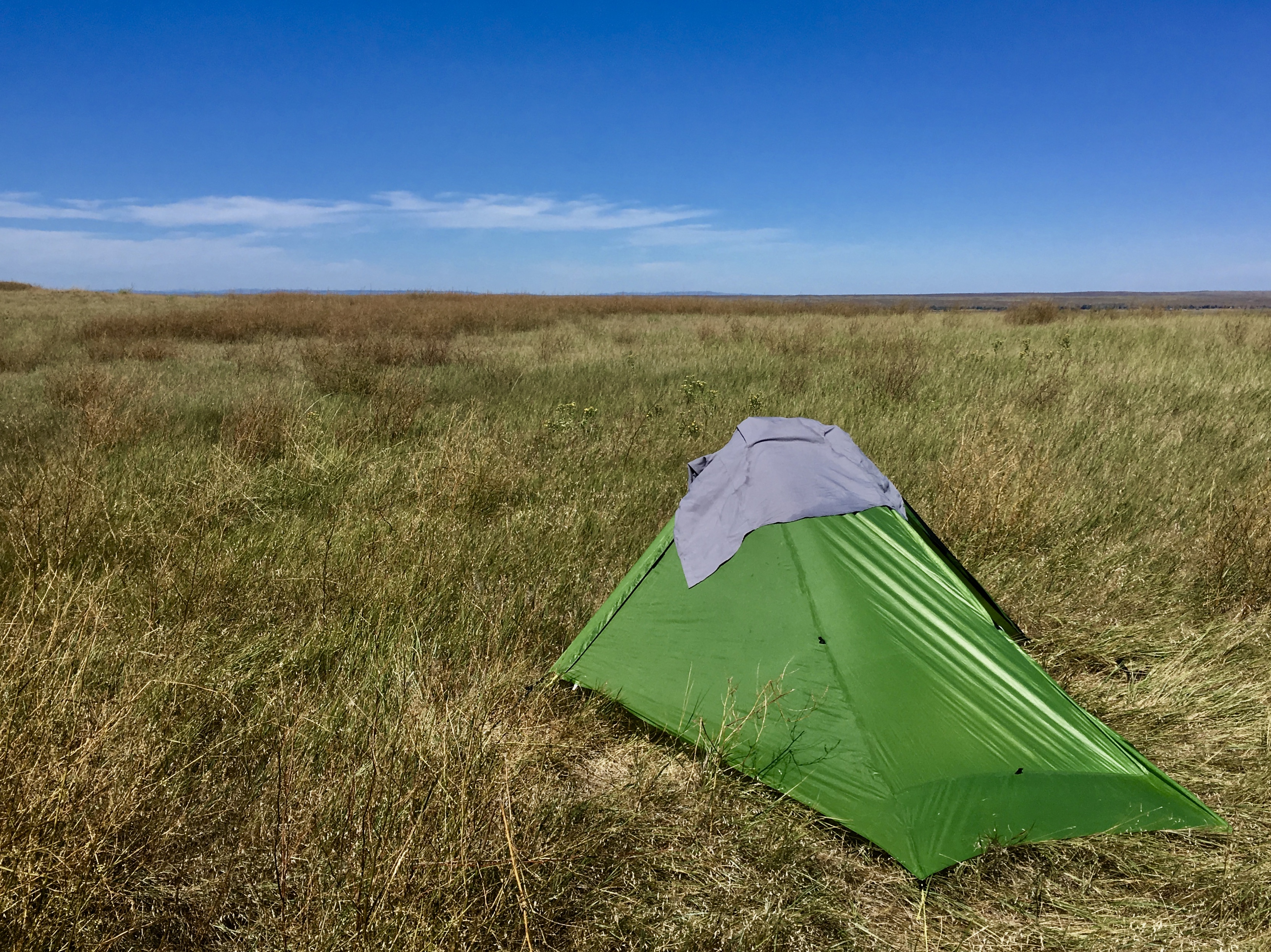
Pony’s tent in the Oglala National Grasslands, Nebraska
Rootstalk: I am impressed by your trail resume.
Evans: Don’t forget, thru-hiking gets all the publicity, but tons and tons of people do what we call section hiking, which is just doing what you can, when you can, over a course of years. When I was on the Appalachian Trail, I met an old guy from Alabama, who started in 1974, and that year, 2016, he was finally finishing. So, there you go. Those options are all there, and you can do anything you want. Here’s my recommendation: if you think you’re interested in long distance hiking, I would highly recommend starting with the Colorado Trail. It’s very doable in less than a month, and it’s spectacularly beautiful. The ratio of reward to effort is much, much higher than on the Appalachian Trail.
Rootstalk: Can you explain how you got your trail name, Pony?
Evans: On the third day of my 2015 hike of the Colorado Trail (my first thru-hike), I walked past an older man who had set up his tent not far off the trail. As I passed, he called out, “Slow down!” Being the sort of person I am, I stopped and asked why he said that to me. His answer, in a nutshell, was that he felt most hikers walk too fast, failing to “stop and smell the roses” and missing out on the experience. I told him I disagreed, noting that first of all, I wasn’t walking that fast, and second, I was soaking up all kinds of experience and absolutely loving it.
“I’m not fast,” I told him. “I just wake up early, put my head down, and go all day without stopping.”
He stroked his chin thoughtfully.
“So”, he said, “you’re like a little mountain pack pony!”
I thought about it for a moment. I remembered once telling a friend of mine that she ran like a gazelle, and she responded that I was like an Icelandic pony—a short, hardy, sturdy breed not exactly known for its speed.
“Yup, I am,” I told the old man, and mosied on. From that moment forward, I introduced myself as Pony.
Incidentally, I later learned that the man, trail name Slow Man, made a habit of doing what he did to me to pretty much every hiker he passed, not just on the CT but also other trails.
I still disagree with him, but I’m grateful for the name, which suits me! 
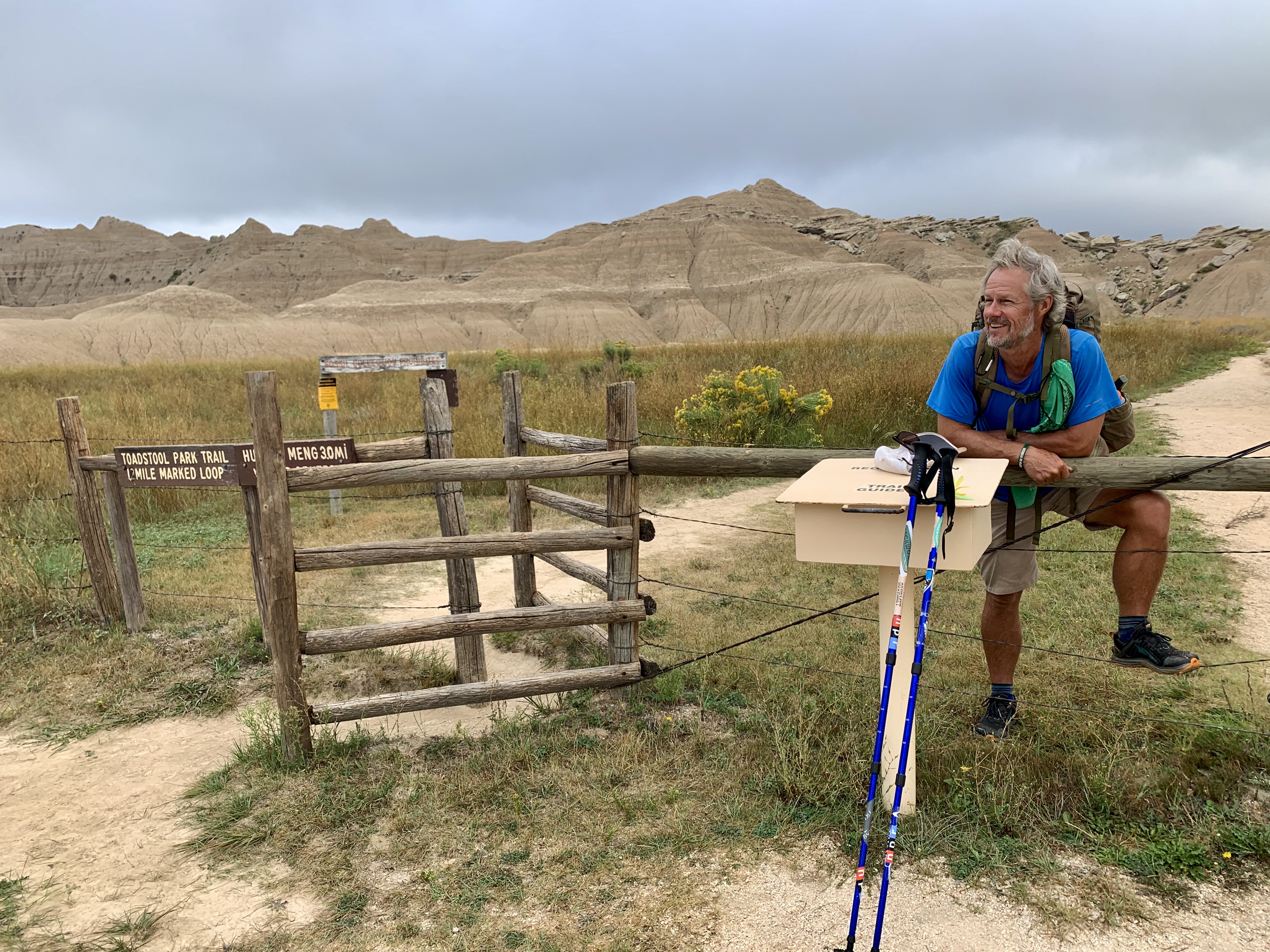
Pony at Toadstool Geologic Park
1 The Bureau of Land Management (BLM) owns nearly 250 million acres of land in the United States, mostly in the western half of the nation. Most BLM land is free to camp on for up to 14 days, making it a popular choice for thru-hikers.